Thwaites Glacier. The Doomsday Glacier.

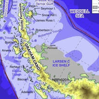
In 1995 the Larsson ‘A’ glacier disintegrated, followed in 2002 by the sudden collapse of the much larger Larsson ‘B’ glacier, neither of which were anticipated. Because sea level rise will swallow up a lot of valuable real estate including London and Miami, the British and American governments put up $50 million between them to do some research on a really big glacier in West Antarctica to find out what is happening.
At that time nobody had set foot on the Thwaites glacier because it is 1500 kilometres from McMurdo camp and satellites did not cover either of the poles so information was scarce. After years of preplanning, it took two years to get an expedition of scientists onto the ice and at the same time a ship approached from the sea with both teams taking measurements and leaving monitoring equipment to measure temperatures and movement plus many other records.
By this time there were also satellites and long-distance reconnaissance aircraft flights which began to build up a picture of the glacier. Much of this scientific work is now being published and the press have labelled Thwaites the Doomsday Glacier because it is on course for terminal collapse starting with the ice shelf collapsing in the next decade, and the rest melting with a potential to raise sea levels by 65 CM if it were to melt completely.
The interesting part about the Thwaites glacier is its overall shape which is like a huge square cereal bowl with a milk jug type lip on one corner of the square and the whole bowl heaped up with cereal, representing the ice above and below sea level.

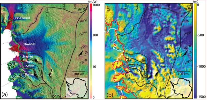
The illustrations show the boundaries of Thwaites. A/ Shows the speed of the glacier where the red section is the exit to the open ocean. B/ Shows the depth of the terrain below the ice with the centre of the glacier 1500 metres below sea level.

The whole glacier is 192,000 square kilometres (New Zealand is 268,000 K) and the milk jug lip facing the ocean is 120 kilometres across. It is this piece facing the ocean (the milk jug lip) which is in imminent state of collapse and it is this that is holding the rest of the ice back.
Most glaciers facing the sea have an ice shelf where the glacier ice has slipped from the land and floated out over the ocean in a tongue but Thwaites is different in that the bulk of the 3500-metre-thick glacier is in a 1500-metre-deep hollow and at the narrow entrance there are a number of small submerged islands that are holding the ice back and it in this narrow region that the concern is concentrated.
Most glaciers facing the sea have an ice shelf where the glacier ice has slipped from the land and floated out over the ocean in a tongue but Thwaites is different in that the bulk of the 3500-metre-thick glacier is in a 1500-metre-deep hollow and at the narrow entrance there are a number of small submerged islands that are holding the ice back and it in this narrow region that the concern is concentrated.

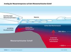
The ice shelf tongue is melting from warm water below and ice cracks in the surface and these should make it collapse in the next decade. This ice is already in the sea and so will not add to sea level rise but if the ice breaks up and goes past the islands it will reach thicker ice and then the big mass of ice will speed up its journey to the sea.
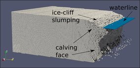
A further complication is that ice has an engineering collapse factor that will only support an ice cliff 100 metres high but when the melting retreats to the thicker ice inside the narrow entrance the ice cliff face will be 2000 metres high and will collapse from its own weight. This higher ice will add to sea level rise.
The result is a very rapid collapse which is why it is called the Doomsday Glacier and result in a 65 CM sea level rise on top of whatever the IPCC report estimates.

